
Maps / Global
Map it out
Mapmaking is an art unto itself, an intricate task of recording the most minute details and, more importantly, interpreting the world for tourists and travellers. But they’re also open to manipulation – once the politicians get involved.
Most people, unless they’re under pressure to find somewhere small while on a big, fast-moving foreign road, usually say that they love maps. They love the stocky icons for churches, the stippled marks for marshland, the blocks for houses and crowded contours for a steep hill. People love mastering the world, plotting it and seeing it, king-like, all laid out before them on a piece of paper or the screen of their phone.
However, maps have big problems as well as many satisfactions. Maps – whether on-screen or on paper – fill a deep psychological need in people: to interpret the world around them so that they don’t get lost. And because maps are really all in the mind, they’re political, as we’ll see in Lebanon on page 109, near-hopeless in a fast-changing country, as we’ll see in China (page 108), and a matter of great pride for a small set of islands, as we’ll see in the UK, below.
Ordnance Survey
Southampton, UK
The Ordnance Survey, like the British armed forces for whom it was originally inaugurated, is an organisation founded on a requirement that became an institution reputed for its adequacies. Now, the army is in tatters – but its mappers are going great guns, thanks.
The Ordnance Survey makes the best maps in the world (in terms of accuracy – what else would “best” be for maps? Best colouring-in?) but they’re an agency that’s often misunderstood. Ninety-nine per cent of people who think of the Ordnance Survey at all think of it as the maker of the maps that your father wrestled with while at the wheel of long summer drives, fretful of melting ice-creams and angry that Tiverton was hidden by the fold; or the maps on which you were tested in geography lessons at school – church-with-a-tower, church-with-a-spire, triangulation-pillar.
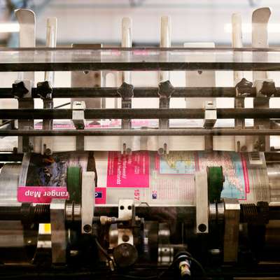


But 90 per cent of the OS’s business isn’t the beloved, foldable-Gospel of the Land Ranger and Explorer series of maps that comprise their “leisure products”. Most work is supplying precise geographical, topographical and land-usage information to businesses – local and national government, big building contractors, energy companies and so on. It’s data. We don’t like data, do we? We like facts. Facts are the charming, anecdotal part of knowledge. Data is the binary minutiae. But data’s what the OS has been doing since 1795 when England was wary of France; data kept Kent and Sussex safe then and the OS has been dressing it up as the rambler’s essential ever since. And beautifully.
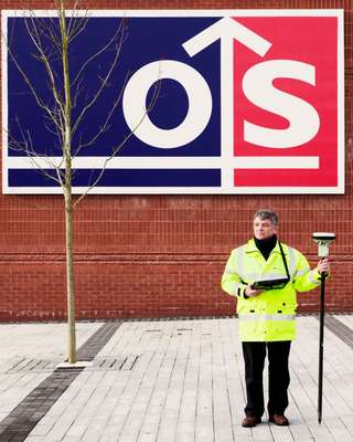
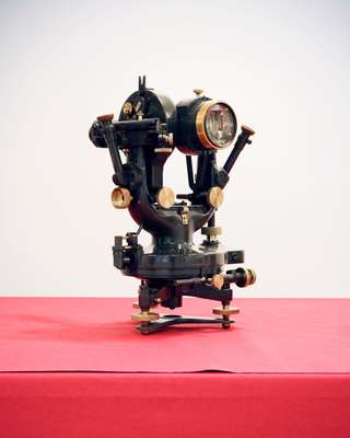
If you want data and detail, Nigel Vincent-Piper is your man. “We work to 2-3cm of accuracy and when you get down to that level, surveying becomes easy,” he says. Vincent-Piper started at the OS in 1972 as a draughtsman and became a surveyor in the early 1980s. Surveyors are the eyes and ears of the OS, the bedrock of the whole thing. In reflective, waterproof outerwear, surveyors drive up and down the contours of the map of the British Isles, measuring new and changed things and making telling notes on what’s there.
“The accuracy’s always been there,” says Vincent-Piper, brandishing his new Leica staff, “but now it’s speedier.” What was a sketching case, a pencil and a measuring tape is now a laptop and this staff – nicely-made plastic with a processor that will communicate with as many Global Positioning satellites as it can, normally 10 or 12. “It can speak to gps and gnss,” he says. “That’s American, Russian, Chinese, Galileo.”
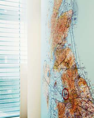
Then there are the 110 stations from Lerwick to the Isles of Scilly that track the constellations of satellites. Vincent-Piper and his 249 other surveying colleagues at the OS have counted that, from country lanes to cathedrals, there are 450 million unique objects on the master map of the British Isles, a document that is updated 5,000 times a day as surveyors upload their findings come tea-time.
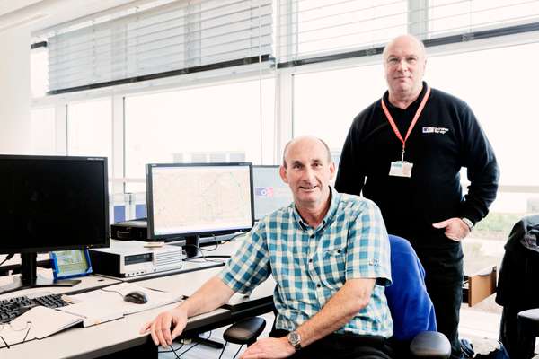
You’ve got your men on the ground and you’ve got your men in the air. Ron Cole and John McGrandle are the Flying Unit and from March until November they ply British skies in one of the two twin-engined Cessnas that the OS leases but paints up in the team colours. “Funny enough, it does look like a map from up there,” says Ron, pulling up a map of London’s Olympic site on his computer. “It’s amazing how much green space there still is, too, even in London.”
Cole and McGrandle fly a tight length of the furrows of their fly-zone and make a teardrop turn at the ends. To the untrained eye, what the Flying Unit does looks a bit like what Googlemaps does: shooting a plan view of the world. But don’t tell them that. “Google does it anytime, in any weather and from satellites,” shrugs McGrandle. “I’m not saying their stuff’s no good, it’s just not the same thing.” The OS’s Flying Unit only go under “champagne skies”: “crystal clear, sunny, as cloudless as you can get – and at 2,500 feet,” explains Cole. Cloudless? In Britain? “That’s why it takes four years to do the whole country,” he chuckles. There’s a Painting-of-the-Forth-Bridge air about much of the painstaking work at the os. Surveying’s driving and detail; the Flying Unit’s the glory stuff; surveying in the sky. The OS hq is full of staff in polarised glasses filling in minute detail in the master plan of the British Isles and then there are the checkers and the double-checkers.
But there’s an art to a map and that’s where cartographers come in. “Cartography’s a language,” says Bob Lilley, the outgoing head cartographer who’ll have been at the OS 43 years, come gold watch time. “People trust maps,” he says, “but unless you have a 1:1 scale you have to compromise, you have to move stuff around, there’s an artistic side to it.”
Lilley is something of a cartography guru – coming from inscribing wax plates with gramophone needles to advising African nations on mapping, giving talks on cartography and recently perfecting “zoomable stacks” (magnify your virtual map without losing definition, detail and feel). Cole and McGrandle might say they have the best job in the os, but there’s a philosophical dimension to Lilley’s thing: portraying on paper what you find on the ground is as artistic an adventure as any. “The heart of what we do is interpreting what’s there,” he says. “We’re showing you what it is.”
OS in numbers
90 Percentage of business that is digital mapping data
250 OS surveyors
403 OS Explorer Maps in the series
1,150 Number of staff
1791 Year of foundation by the Board of Ordnance
1801 Year the first Ordnance Survey map was published (of Kent)
1999 The OS has had government “trading fund” status since this year, giving it more freedom for finances and planning
50,000 Average number of aerial photos captured from planes every year
2.5 million Amount of paper maps produced each year
450 million Number of individual features that are included on the most detailed Ordnance Survey mapping of Great Britain – including everyone’s house and even every Royal Mail pillar box

A digital boom market
China
In China, where cities sprout instantaneously, keeping maps up to date is an epic task. As a result, paper maps are a dying breed in the country as legions of new drivers and tourists turn to digital maps like the ones offered by Baidu, China’s largest internet search engine, to find their way around. “We estimate that the number of people who use digital maps in a single week now surpasses the number of people buying paper maps in an entire year,” says Huang Wei, product manager for Baidu’s mapping division.
Baidu has cornered the online mapping market in China because it thinks innovatively while also playing by the rules. Last year, it was one of 31 companies awarded licences to provide digital mapping services as part of the government’s ever-intrusive attempts to control online information. (Google, tellingly, was not granted a licence, though its mapping service is still available in China —for now.)
While Baidu has agreed not to identify certain locations – military installations and the like – it is steadily expanding its array of interactive maps to appeal to young, urban Chinese less fussed with sensitive political matters.
The government has now entered the online mapping fray itself, launching a new service with Chinese and English place names called Map World last year to compete with Baidu. But Baidu needn’t worry just yet—Map World has made some glaring missteps, such as relocating the Russian city of Khmelevaya to the outskirts of Inverness.

Playing at politics
Lebanon
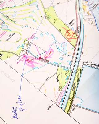
A population forced to show identity cards to travel across cities. A village straddled over two countries. A fisherman detained for trespassing an ill-defined maritime border. Frontiers in the Middle East are still dangerously shifting. For cartographers, borders are a big headache. The field is still very much in the hands of armies and politicians, who keep a tight noose around cartographic findings. Even local populations, who rely on ad hoc landmarks to move around, view maps with suspicion. “Reading and using a map is neither common nor traditional in the Middle East,” says Bahi Ghubril, an entrepreneur who published Zawarib, Beirut’s first “A to Z” guide.
Google Maps and drastic signage measures in some countries (the uae and Jordan come to mind) are changing things but there is no substitute for field surveys. And this is where things can get dangerous. In Lebanon, a tiny state with contested territory, the obstacles and occasional absurdities are plenty.
For a start, frontiers with Syria are porous, often controlled by smugglers and militias. In the south, the border with Israel, peppered with landmines and guarded by UN peacekeepers, is closed. (Because the two countries are officially at war, Israel is never mentioned on a Lebanese map.) As for the maritime border, the government only demarcated it when natural gas was discovered in the Mediterranean last year, leading to on-going contention over an 850 sq km stretch of sea with its southern neighbour. In practical terms this means the army has cordoned off all of south Lebanon to cartographers. “We can’t fly south of Saida and we are advised to avoid Palestinian refugee camps as well as some embassies in Beirut,” says the director of one of the rare companies to conduct aerial surveys.
Perhaps because territory is still a national security issue (notably for Lebanon’s powerful Hezbollah), the government has yet to install gps relay stations, which would render cartographers’ work more precise but also reveal to enemies secret tunnels, trenches and passageways. To make matters more constraining, private companies must hand over any maps or updates to the army’s cartographic department. Founded in 1962, the Department for Geographic Affairs within the Defence Ministry caters mainly to the army but produces occasional (rather pricey) tourist maps.
Despite all the hurdles, entrepreneurial mapmakers see a potential for growth. “We’re not only creating a product, we’re on a mission to convince ordinary Lebanese that maps can save them time and money,” says Ghubril, Zawarib’s creator. “Imagine the potential for ambulances, delivery services and taxis.”
With few formally named streets in the capital, pharmacies, schools, mosques or even shops with a neon light lend their name to a street. “Using such a method in a big European country would be inconceivable,” admits Carl Stephan, the founder of Bureau Stephan, one of Lebanon’s oldest companies for photogrammetry and cartography.
Yet since the publication of the first Beirut atlas five years ago, work is paying off. “More and more people use a map to advertise a new business or an event,” says Ghubril. Beirut’s municipality has also commissioned his firm to create the first set of public maps. And a bus map showing the anarchic routes of the fearless minibuses zooming across town is also under consideration. Meanwhile, more firms are offering navigation systems based on satellite imagery for ordinary Lebanese. Rumour has it they are being used to monitor philandering spouses.
